W6/CV-006 Campbell Mountain – 1st SOTA Activation
- activated by KG6YJ on Feb.16 and Feb.17, 2023, UTC.
Campbell Mountain is in the Central Valley of California, the closest big city is Fresno. I’m so happy to be the first activator of this mountain. It’s a private property, a permit is needed to access, hike and do SOTA activation there.
For those who just want
to know how to get there and get permit, you may skip the "Research and Planning" section and jump to Drive to Campbell Mountain.
- Research and Planning
- Drive to Campbell Mountain
- Got the Permit
- Climb the Mountain
- Arrive at the Peak
- CQ SOTA
- Descending
Research and Planning
Around the beginning of year 2023, I got confirmation that on Feb.16 I need to drop off my daughter to Fresno for her high school musical event. That’ll only cost half a day, I’ll have the whole afternoon that I can enjoy by myself over there. So I browsed POTA and SOTA maps to see if there’s any nearby interesting locations that I can do an activation, a few places appeared on the radar:
- Millerton Lake State Recreation Area (POTA K-8325)
- Owens Mountain (SOTA W6/SS-565, 1608 ft, no activation yet)
- Jesse Morrow Mountain (SOTA W6/CV-002, 2110 ft, no activation yet)
- Campbell Mountain (SOTA W6/CV-006, 1752 ft, no activation yet at that time)
POTA activation is good, but none of these 3 mountains was activated yet, that sounds interesting: what if I become the first activator of one of them? That must be fun.
Research started.
- Owens Mountain has FM and other antennas on the top, its access road is behind a gate near Auberry Road, as shown in Google Maps Satellite View. A hiker mentioned online that he parked his car on Auberry Road, crossed 2 fences and hiked 3+ miles onto Owens Mountain, that may be a little long.
- Jesse Morrow Mountain looks taller and bigger than the other two, farther away from nearby roads.
- Campbell Mountain looks more roundish, close to nearby roads, estimated one way distance from base to peak is about < 1.5 miles, seems promising. The problem is how to get access.
The focus became Campbell Mountain. Google Map’s Street View and Satellite View, also Google Earth were used to look at different aspects of the mountain, and all the nearby roads and features:

The map shows 3 businesses around the mountain:
- Peg Field-42CN airport
- Hidden Hollow, a wedding service company
- Kiku Floral, a flower shop
I contacted with them one by one.
- Airport: their phone number listed on Google Maps was out of service. I filled up an online form on their website and immediately got feedback, saying Mr. Freeman is the owner/conservator of the mountain, he is also the local CEO of a cattle company, which has a mailing address that was shared to me.
- Wedding company: I called and was answered by a nice lady. They tried to reach out to a person who knows the owner of the mountain, but that person didn’t get back to them. She mentioned sometimes the owner hosts a hiking event going onto the top of the mountain, and there’re a lot of rattlesnakes on the mountain in hot days, “a lot”, she emphasized. Sounds scary.
- Flower shop: I called and was answered by their lady owner, she mentioned Freeman family owns the mountain. She tried to reach the owners of the property, but didn’t have result.
Based on above, I know Campbell Mountain is a private property owned by Freeman family, therefore a permit is needed to get access there. I’ll need to get the contact info of Freeman family to get the permit.
Campbell Mountain has 2 giant letters on it: letter “S” on the western slope facing the city of Sanger, letter “R” on the southern slope facing the city of Reedley.
Its Wikipedia page lists an old news as a reference: Students paint boulders, refresh "S" on mountain east of Sanger. The news says some Sanger High School students painted the letter “S” in March 2019. To get some clue, I called Sanger High School, and was told that was done by some students who already graduated, they suggest me to contact city of Sanger to get further information.
City of Sanger replied my email, confirming the mountain is in fact private, they don’t have contact info. The letter “S” was painted by high school students and didn’t include city participation.
City of Reedley also responded to my email, saying the "R" mountain is located outside of their city limits, it is private property, they don’t know who the current property owner is.
These 2 letters didn’t give me any new information.
Google Maps Satellite View shows there’re 2 locations that nearby roads are closest to the mountain: Jensen Avenue and Mountain Way. I used Google Maps Street View to look at these roads.
- The western end of Jensen Avenue shows some agricultural equipment and structures.
- Mountain Way area has a residential area (the * location in above picture), it’s the closest location to letter “R” and then the peak. I started to visualize that I park my car in their front yard and go hiking from their back yard…
But Mountain Way doesn’t have a Street View. Below is a zoom-in view picture of Mountain Way area, only the yellow color sections have Google Maps Street View, which ends at the northern end of Usry Avenue.

Research ended here. Based on my research, a plan was worked out:
- Drive to Mountain Way to see if there’s any luck talking to people to get contact information of the property owner, then try get the permit, climb Campbell Mountain and do a SOTA activation;
- If no luck, drive to Jensen Avenue to see if the chance appears over there;
- If still no luck, go visit Millerton Lake SRA for a POTA activation.
Drive to Campbell Mountain
On Feb.16, 2023, Thursday, around noon time, I left Fresno downtown area and drove along CA-180 towards east direction:

My destination was set to the northern end of Usry Avenue. Not sure why Google Maps names that location as “Kings Canyon Joint Unified School District”:

After passing the city of Sanger, I could see two small mountains on both sides of CA-180 highway: Jesse Morrow Mountain and Campbell Mountain:

The view was beautiful. Following the GPS, I turned right onto S Frankwood Avenue, then turned left onto Central Avenue, passed orchards and fields.

Around 12:40pm, I arrived at the northern end of Usry Avenue, where the Google Maps Street View stops at. Campbell Mountain was right in front of me, but it’s behind a fence. A sign on the fence says “Private Property”.

From the photo you can see the mountain itself doesn’t have a single tree on it, just rocks and grass.
The right side road goes along the north side of an orchard. The left side road (Mountain Way or Freeman Road) goes through a “Rancho Freeman” gate and then a few residential areas.
Got the permit
I enjoyed the view for a few minutes, with the impression that the Mountain Way is a private road that I cannot drive on. Nobody was around, I was guessing I had to leave. Then I saw a car was moving from the far end of Mountain Way towards me, with its headlights on. Great, at least I could talk to somebody. I waved to the car.
The car came out of Rancho Freeman gate and stopped by, it was a light color pick-up truck driven by a gentleman. I asked him how to get permit to go hiking onto Campbell Mountain, he said Freeman family is at the first house along Mountain Way, I could simply drive over there and talk to them.
I drove over, learned how to open and close the wire gate on the road to Freeman’s house:
There were a few people talking inside the house. I spoke to a young lady who is Freeman’s daughter, she quickly said OK to me. She said they just want to make sure people know somebody is on the mountain.
I asked her how long time does it take to climb to the peak, she said about 1-2 hours. She said they usually need that much time to reach the letter “R”, then go to the peak. She said I can follow the trail if there is, or I can climb directly towards the peak.
I asked her about rattlesnake, she said right now (February) is not the season yet, there’ll be more rattlesnakes in hot days, but do pay attention. That made me feel much better.
She said I can park my car right at the mailbox, then I can open the wire gate to the ranch. She reminded me to close the wire gates after I pass each of them.
That was nice, I was so happy to get her verbal permit!
Climb the Mountain
Around 1pm, I parked my car at the mailboxes. Threw in another 2 bottles of water into my backpack, adjusted my hiking poles, then off I started.

After passing the 1st wire gate, I walked along the wheel tracks on the grassland for about 5 minutes, then arrived at the 2nd gate.
Behind the 2nd gate, I thought I should still follow the wheel tracks for a while until I see the “trail” switches back, that was why I turned right direction (east). But after walking a while, I didn’t see the trend of switching back of the trail, I knew it was a wrong way. Then I returned back to the 2nd gate and kept walking west.
I tried to follow the visible “trail”, that was not a maintained trail, just a relatively flat walking track. Pretty soon I reached a water tank under a few big trees where there were quite some cows. They were scared by me and started to walk away (west), I knew I need to keep a safe distance from them, therefore I didn’t follow them towards west, instead I started to climb towards the peak (north), almost perpendicular to the contour lines of the mountain.
It was a little steep, there was no trail, I tried to follow the cow tracks so that it was easier to climb and less chance to get in undisturbed area where snakes might be hiding. I used my hiking poles to punch into dirt and rocks to make some noise, letting nearby snakes to hear the sound and keep away from me. Frequent stop and rest were needed to enjoy the water and view. Sierra Nevada was covered by snow in the background, orchards and grassland were all green, with Freeman’s house in the front, it was a nice view.
I climbed higher and higher, at one point I was at the same elevation of the letter “R”, but still at the east side of it. I didn’t have a need to visit letter “R”, so I saved a screen capture of Satellite View and kept going up.

Now I had some feeling of a bird’s view from an airplane, I could clearly see Freeman’s house and another house along Mountain Way. Freeman’s house is not shown in Google Maps Satellite View yet, it might be a relatively new building.

Along the way, sometimes there were a lot of rocks, while other times it was dirt and grass which was easier to walk on. After about 1 hour my AllTrails app showed that I had walked 1.5 miles, and gained 880 feet elevation. I was already higher than the letter “R” and close to the peak, as Satellite View showed. It was not far away from the peak!


It’s always satisfying to be on the top of a mountain. Looking east, there were other mountains extending all the way to Sierra Nevada; on the west, Central Valley of California was right under this mountain, nothing blocking it, because Campbell Mountain is one of the first mountains at the east side of Central Valley.

There were 3 piles of big rocks on the peak: west, middle and east, in between there were dirt and grass. Each of the west and middle piles of rocks has a survey marker:

and the middle pile had many graffiti:

The peak had big rocks, grassland, and some 4x4 wooden poles (which may be useful to tie antenna rod on):

Having hung around for a few minutes on the peak, at about 2:40pm, I took a screenshot of the HamGPS app, showing useful information for ham radio:

Then I pulled out my HT and log book, started to call “CQ SOTA” at 146.520MHz, the 2-meter calling frequency.

After calling for a few minutes, I had a QSO with KN6OCI, Richard. He was in Hanford which is about 40 miles down south, he reported my signal was 59+. Then I did a self-spotting using SOTA Activator app.
Cell phone coverage on the peak was not bad. It seemed not too many people monitoring this 2-meter calling frequency. About 10 minutes later I failed to copy the callsign of K?6ECR, then later made the 2nd QSO with KD6BYL and told him the height of Campbell Mountain is 1752 feet.
I changed to 70cm band 446.000MHz calling frequency where I had the 3rd QSO with K6STB, Tom, and gave him Campbell Mountain’s SOTA reference number W6/CV-006. Then I tried 1.25-meter band at 223.500MHz but no result. Eventually I went back to 146.520MHz and had the 4th QSO with N6BYH.
I got the needed 4 QSO’s for SOTA activation, that cost 40 minutes already, the efficiency was too low. But there was no pressure anymore, I could try HF using either FT8 or CW.
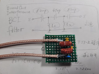
At about 3:40pm, I set up my DIY ¼ wavelength vertical antenna on my tripod, with its 4 counterpoise wires laid down towards different directions.
I was the only person on the peak, nobody competed with me for the space. It was sunny with some clouds, the temperature was moderate. There was no wind at all, which was great, otherwise I had to lean the telescopic antenna whip against something for better support – which I learned on Mount Diablo in December, 2022 when it was pretty windy there.
I decided to try CW first. For CW, I am a brand new op, I only did a few S&P before, never called CQ yet. This would be my first time calling CQ using CW mode, ever! I tuned the antenna by adjusting the length of its telescopic whip and watching the S11 return loss on nanoVNA so that the antenna resonated at around 14.050MHz. I used an SW-3B QRP CW transceiver borrowed from N6HAN. All my goodies were laid down in front of me, I sat on the ground facing the antenna and south direction.
20-meter band was not that busy, 14.062MHz was quiet. I called “QRL?” twice, nothing heard. Then I started to call “CQ CQ CQ SOTA DE KG6YJ KG6YJ K” once before I did self-spotting using SOTA Activator app and started my little digital voice recorder. This is my first CW CQ calling ever!
I called again: “CQ CQ CQ SOTA DE KG6YJ KG6YJ K”, and heard a weak signal coming in, I had to boost up both RF and AF gains to hear it. It was K7UOU in AZ. In the QSO with him, I kept making mistakes when fiddling my paddles…
After finishing QSO with him, the strong WW7D came in, really strong. I had to turn down the RF and AF gains for his signal. Also I needed to delay for a few seconds between QSO’s so that I could write down the previous QSO time onto my log paper. Both my hands and brain were nervous, I could only copy the key words, mainly call signs and RST reports.
WW7D’s logged QSO time was right at 0000 UTC on Feb.17, 2023, that was another UTC day already!
After WW7D in WA, there came a pile-up! As a new op, I was frightened and couldn’t even tell a single clue… After a few seconds, I just transmitted a “?” instead of even a “W?” or “K?”, HI HI.
This time a smaller pile-up came in, I picked up WU7H in WA whose callsign was easier to recognize.
Then another smaller pile-up came in, I picked up WD8KDB who was slower than others because I am a new op.
Then K7ATN in OR. I was busy handling the QSO’s and my pencil and paper log. After the 5th QSO with N7MQ in WY in the new UTC day, the frequency became quiet. It was about 4:10pm. I only spent less than 15 minutes for 5 QSO’s, high efficiency.
Since I already had 5 QSO’s for the new UTC day, more than the needed 4, I didn’t call another round of CQ. Instead, I transmitted: “DE KG6YJ KG6YJ TU QRT QRT 72 E E” to announce my end of work, and prepared to pack up. I knew I had to come down the mountain before the sunset, and drive 2.5 hours back home in the dark. I heard at the same frequency somebody was calling “QRL?” using CW, then I turned off the power and started to pack up.
Yay, I called my first ever CW CQ, and did SOTA activation successfully at this “brand new” mountain!

Around 4:40pm, everything
was packed up, I started to descend directly towards Freeman’s house because the
steepness looked not that bad. My hiking poles were adjusted to their longest,
they helped me a lot when I came down. Again, I used hiking poles to punch into
the dirt and rocks to make noise to scare away any potentially nearby
rattlesnakes, also trying to follow the “cow trail” if any.

Descending was much
faster than ascending. Before I realized I need to take a few photos, I was
already far away from the peak. Here was the view of the peak when I looked
upwards from where I stood:

The sun ray’s color
started to get warmer and warmer, both the trees and myself had long shadows.
Nice view of a beautiful day.


Pretty soon I was at
the base of the mountain and ready to pass the 2nd gate:

At the 2nd gate I noticed far away a pick-up truck was waiting for me at the 1st
wire gate. Probably somebody wanted to talk to me for something? Nevertheless, I
kept moving along the wheel tracks on the ground.

It was around 5:25pm when I arrived at the 1st wire gate. The gentleman open the gate for me, saying he just wanted to make sure I didn’t lose a leg or was bitten by a snake, ha ha! I showed him some photos that I took on the peak, and also my AllTrails app GPS trace:

He asked about a water tank and a spring in the peak area that I didn’t see, then he joked “Oh you missed them, you need to climb one more time.😀
After making sure I had nothing wrong, he drove away along Mountain Way. He was so kind. Now I was alone on the street by myself, I was so happy that I jumped and yelled “yay”: I became the first activator of Campbell Mountain!
Before leaving, I took a few more photos around the area. Looking north towards the mountain:

Looking west towards
Rancho Freeman:

Looking east towards Sierra Nevada:

Looking south towards Usry Avenue from where I came:

What a wonderful day, my first time to call a CW CQ, and I became the first activator of Campbell Mountain!

Comments
Post a Comment